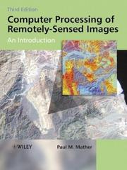
Computer processing of remotely-sensed images
Paul M. Mather · 1987
איפה לקנות
המחיר באמזון משתנה מדי יום, אז הכי נכון לראות אותו שם ברגע הקנייה.
לצפייה באמזוןזה קישור שותפים: כשקונים דרכו, האתר מקבל עמלה קטנה בלי תוספת במחיר עבורכם, וזה עוזר לנו להביא תוכן איכותי ולתחזק את האתר. בתור שותפים של Amazon אנחנו מרוויחים מרכישות מתאימות.
על הספר
Remotely-sensed images of the Earth's surface provide a valuable source of information about the geographical distribution and properties of natural and cultural features. This fully revised and updated edition of a highly regarded textbook deals with the mechanics of processing remotely-senses images. Presented in an accessible manner, the book covers a wide range of image processing and pattern recognition techniques. Features include: New topics on LiDAR data processing, SAR interferometry, the analysis of imaging spectrometer image sets and the use of the wavelet transform. An accompanying CD-ROM with: updated MIPS software, including modules for standard procedures such as image display, filtering, image transforms, graph plotting, import of data from a range of sensors. A set of exercises, including data sets, illustrating the application of discussed methods using the MIPS software. An extensive list of WWW resources including colour illustrations for easy download. For further information, including exercises and latest software information visit the Author's Website at: http://homepage.ntlworld.com/paul.mather/ComputerProcessing3/ Note: CD-ROM/DVD and other supplementary materials are not included.
המשפט הראשון: The science of remote sensing consists of the interpretation of measurements of electromagnetic energy reflected from or emitted by a target from a vantage-point that is distant from the target.
פרטי הספר
- שנה
- 1987
- שפה
- English
- הוצאה
- John Wiley & Sons Inc
- מהדורות
- 12
- עמודים
- 366
- ISBN
- 9780471926535
מקור הנתונים: Wikidata