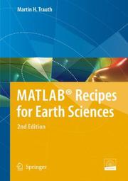
MATLAB® Recipes for Earth Sciences
Martin H. Trauth · 2010
איפה לקנות
בדקו את המחיר העדכני באמזון. אנחנו לא מציגים מחירים כי הם משתנים מדי יום.
לצפייה באמזוןקישור שותפים. בתור שותפים של Amazon אנחנו מרוויחים מרכישות מתאימות.
על הספר
MATLAB® is used for a wide range of applications in geosciences, such as image processing in remote sensing, the generation and processing of digital elevation models, and the analysis of time series. This book introduces methods of data analysis in geosciences using MATLAB, such as basic statistics for univariate, bivariate and multivariate datasets, jackknife and bootstrap resampling schemes, processing of digital elevation models, gridding and contouring, geostatistics and kriging, processing and georeferencing of satellite images, digitizing from the screen, linear and nonlinear time-series analysis, and the application of linear time-invariant and adaptive filters. The revised and updated Third Edition includes ten new sections and has greatly expanded on most chapters from the previous edition, including a step by step discussion of all methods before demonstrating the methods with MATLAB functions. New sections include: Data Storage and Handling, Data Structures and Classes of Objects, Generating M-Files to Regenerate Graphs, Publishing M-Files, Distribution Fitting, Nonlinear and Weighted Regression, Color-Intensity Transects of Varved Sediments, and Grain Size Analysis from Microscope Images. The text includes numerous examples demonstrating how MATLAB can be used on data sets from earth sciences. All MATLAB recipes can be easily modified in order to analyse the reader's own data sets. The online files accompanying the book contain exemplary data sets and a digital version of the MATLAB recipes.
פרטי הספר
- שנה
- 2010
- שפה
- English
- הוצאה
- Springer-Verlag Berlin Heidelberg
- מהדורות
- 8
- עמודים
- 336
- ISBN
- 9783642127618
מקור הנתונים: Wikidata
עוד של Martin H. Trauth