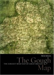
The Gough Map
Nick Millea · 2005
איפה לקנות
בדקו את המחיר העדכני באמזון. אנחנו לא מציגים מחירים כי הם משתנים מדי יום.
לצפייה באמזוןקישור שותפים. בתור שותפים של Amazon אנחנו מרוויחים מרכישות מתאימות.
על הספר
For centuries the Gough Map has amazed observers with its remarkable detail and baffled historians with its hidden secrets: who made it and why was it made? This gorgeously illustrated volume offers possible answers to these questions with a detailed examination of the map that employs the latest in technology, cartographic theories, and historical research. Recent digitization of the Gough Map has made it more legible than at any other time since its arrival at the Bodleian Library in 1809. This work utilizes new georectification technology to project a modern map of Britain over the Gough Map, revealing the incredible accuracy of the 700-year-old manuscript. In stunningly detailed reproduction, The Gough Map charts a vast array of cities, routes, and landmarks, including the principal medieval settlements of Bristol, Oxford and Norwich; the Severn, Thames, and Humber rivers; the loop of the Wear at Durham; and routes between towns with distances marked in Roman numerals. The volume also features a color fold-out print of the Gough map, as well as numerous close-up images of each area. The Gough Map offers an unparalleled opportunity to examine this fascinating example of medieval mapmaking.
פרטי הספר
- שנה
- 2005
- שפה
- English
- הוצאה
- Bodleian Library, University of Oxford
- מהדורות
- 2
- עמודים
- 112
- ISBN
- 9781851240159
מקור הנתונים: Wikidata