Clemens M. Steenbergen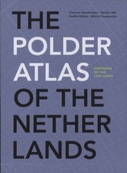
The polder atlas of The Netherlands
Clemens M. Steenbergen · 2009
על הספר
The "Polder Atlas of the Netherlands" is a milestone in the history of landscape studies in the Low Countries. With about 300 maps, drawing and photographs from the air the more that 4000 polders are here systematically analyzed. In one digital map all polders can be traced by means of the coordinates and registers. By means of 17 examples the details of the shape differences and type of polder can be typologically mapped. All in all this atlas presents a comprehensive survey of the developments of the polderlandscape.
פרטי הספר
- שנה
- 2009
- שפה
- English
- הוצאה
- Uitgeverij Thoth
- מהדורות
- 1
- עמודים
- 639
- ISBN
- 9789068685190
מקור הנתונים: Wikidata
עוד של Clemens M. Steenbergen
Clemens M. Steenbergen
Metropolitan landscape architecture
Clemens M. Steenbergen · 2011
Clemens M. Steenbergen
Atlas of the New Dutch Water Defence Line
Clemens M. Steenbergen · 2009
Clemens M. Steenbergen
Ontwerpen met landschap
Clemens M. Steenbergen · 2008
Clemens M. Steenbergen
Strategisch laagland
Clemens M. Steenbergen · 2006