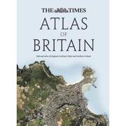
The Times Atlas of Britain
Various · 2010
על הספר
The first ever national Atlas of Britain to be published for over 40 years. This first edition of The Times Atlas of Britain is perfect for finding out more about Britain, discovering your county or just exploring the country. Includes England, Wales, Scotland and Northern Ireland. An authoritative and prestigious atlas with detailed mapping and geographical information about Britain. England, Wales, Scotland and Northern Ireland are given comprehensive coverage along with every county. Fully up-to-date reference maps, statistics, images and historical mapping give an exceptionally detailed view of Britain. A brand new atlas in the Times range covering the whole of Great Britain. The following features are included in this unique atlas - • 160 pages of Times reference mapping • 17 city centre maps • 450 photographs • 90 historical maps • 100,000 words of text Pages on each county contain the following; • flag/crest • description • at a glance statistics • photographs • modern map in times mapping style • historical map of county from the Bartholomew archive • Fascinating descriptions from John Bartholomew's "Gazetteer of the British Isles" 1887 • list of well known people born in the county • quote from celebrity about the county The Worlds Most Prestigious and Authoritative Atlases www.timesatlas.com
פרטי הספר
- שנה
- 2010
- שפה
- English
- הוצאה
- Times Books (HarperCollins)
- מהדורות
- 1
- עמודים
- 448
- ISBN
- 9780007345830
מקור הנתונים: Wikidata
עוד של Various