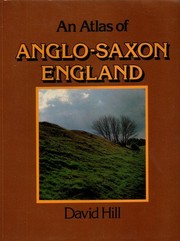
An atlas of Anglo-Saxon England
David Hill · 1981
Where to buy
Amazon’s price changes daily, so the most accurate place to see it is there, at the moment you buy.
View on AmazonAbout the book
The remarkable series of 244 maps and charts in this book comprise the first atlas of Anglo-Saxon England. It will be an indispensable companion to scholars and students of early English history and archaeology. The book covers every major aspect of Anglo-Saxon culture and history that may be expressed in graphic terms -- sea level changes, settlement patterns, place names, invasions, campaigns, mints and coinage, important itineraries, land holdings, mining, agriculture, trade, towns, monasteries and the Church. Wherever appropriate, David Hill sets English developments in their European context. The book is very much more than a straightforward work of historical exegesis. It bears the stamp of its author's vision and imagination and is informed by new historical and archaeological research. The author has provided a concise commentary to accompany the maps, and a comprehensive index of place names. - Back cover.
Book details
- Year
- 1981
- Language
- English
- Publisher
- University of Toronto Press
- Editions
- 3
- Pages
- 180
- ISBN
- 9780802064462
Data source: Wikidata
More by David Hill