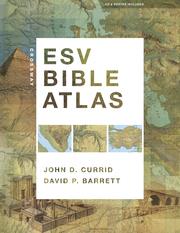
Crossway ESV Bible Atlas
John D. Currid · 2010
Where to buy
Amazon’s price changes daily, so the most accurate place to see it is there, at the moment you buy.
View on AmazonAbout the book
Capitalizing on recent advances in satellite imaging and geographic information systems, the Crossway ESV Bible Atlas offers Bible readers a comprehensive, up-to-date resource that blends technical sophistication with readability, visual appeal, and historical and biblical accuracy. All the key methods of presenting Bible geography and history are here, including more than 175 full-color maps, 70 photographs, 3-D re-creations of biblical objects and sites, indexes, timelines, and 65,000 words of narrative description. The atlas uniquely features regional maps detailing biblically significant areas such as Egypt, Mesopotamia, Italy, and Greece. It also includes a CD with searchable indexes and digital maps, and a removable, 16.5 x 22-inch map of Palestine. This carefully crafted reference tool not only sets a new standard in Bible atlases but will help ESV readers more clearly understand the world of the Bible and the meaning of Scripture. - Publisher.
Book details
- Year
- 2010
- Language
- English
- Publisher
- Crossway
- Editions
- 1
- Pages
- 352
- ISBN
- 9781433501920
Data source: Wikidata
More by John D. Currid