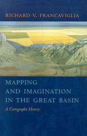
Mapping And Imagination In The Great Basin
Richard V. Francaviglia · 2005
Where to buy
Amazon’s price changes daily, so the most accurate place to see it is there, at the moment you buy.
View on AmazonAbout the book
"The Great Basin was the last region of continental North America to be explored and mapped, and it remained largely a mystery to European Americans until well into the nineteenth century. In Mapping and Imagination in the Great Basin, geographer-historian Richard Francaviglia shows how the Great Basin gradually emerged from its "cartographic silence" as terra incognita and how this fascinating process both paralleled the development of the sciences of surveying, geology, hydrology, and cartography, and reflected the changing geopolitical aspirations of the European colonial powers and the United States." "Francaviglia's remarkable interdisciplinary account of the mapping of the Great Basin combines an exciting chronicle of the exploration of the region with a history of the art and science of cartography and of the political, economic, and cultural contexts in which maps are created. It also offers a compelling, wide-ranging discussion that combines a description of the daunting physical realities of the Great Basin with a cogent examination of the ways humans - from early Native Americans to nineteenth-century surveyors to twentieth-century highway and air travelers - have understood, defined, and organized this space, psychologically and through the medium of maps."--Jacket.
First sentence: TO WAYFARERS IN THE EARLY twenty-first century, the Great Basin one of those seemingly empty spaces that once punished the traveler but are now easily crossed unless one makes a mistake or miscalculation.
Book details
- Year
- 2005
- Language
- English
- Publisher
- University of Nevada Press
- Editions
- 3
- Pages
- 256
- ISBN
- 9780874176094
Data source: Wikidata
More by Richard V. Francaviglia