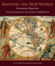
Mapping The New World Renaissance Maps From The American Museum In Britain
Anne Armitage · 2013
Where to buy
Amazon’s price changes daily, so the most accurate place to see it is there, at the moment you buy.
View on AmazonAbout the book
Illustrating the changing shape of the Americas as Renaissance cartographers (working from ancient and medieval sources) learned more of the New World, this collection is the third in a series produced by Scala, which showcases the core collections of the American Museum in Britain. Spurred on by thoughts of treasure - particularly gold, silver, gems and spices - European travellers changed the shape of the New World as they mapped the Americas from the 15th to the 17th centuries. Whereas medieval maps illustrated theology rather than geography, the Renaissance revived the classical discipline of scientifically mapping land mass. Such precision was entirely practical: only by exact measurement could the rich New World territories be claimed, plundered and ruled by its Old World conquerors.
Book details
- Year
- 2013
- Language
- English
- Publisher
- Antique Collectors' Club Ltd
- Editions
- 1
- Pages
- 128
- ISBN
- 9781857598223
Data source: Wikidata