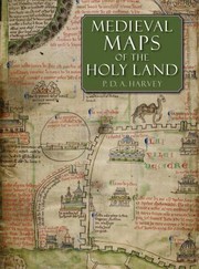
Medieval Maps of the Holy Land
P. D. A. Harvey · 2012
Where to buy
Amazon’s price changes daily, so the most accurate place to see it is there, at the moment you buy.
View on AmazonAbout the book
"Neglected since the 1890s, the eight medieval regional maps of the Holy Land that are known to have existed are interesting, picturesque and mostly colourful. Many of the surviving copies and fragments are reproduced here for the first time, including three large maps that are among medieval Europe's finest cartographic monuments. Painstaking detective work on the manuscripts reveals much that is new: two maps lurking behind others drawn over them, a map changed into an erotic fantasy by a nineteenth-century forger, the origin of the mysterious grid pattern on some of the maps and much else. This beautifully produced large-format book is an important contribution to our understanding of medieval culture, early mapping and crusading Europe"--
Book details
- Year
- 2012
- Language
- English
- Publisher
- British Library
- Editions
- 1
- Pages
- 160
- ISBN
- 9780712358248
Data source: Wikidata
More by P. D. A. Harvey