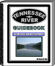
Tennessee River Guidebook
Jerry M. Hay · 2010
Where to buy
Amazon’s price changes daily, so the most accurate place to see it is there, at the moment you buy.
View on AmazonThis is an affiliate link: if you buy through it, the site earns a small commission at no extra cost to you, which helps us bring quality content and maintain the site. As an Amazon Associate we earn from qualifying purchases.
About the book
This guidebook has it all! No cruising guides, charts or digital sources have as much detailed information in one source. Don't chance running out of fuel, food or supplies. Know where the hazards are. Be prepared for your river cruise or float by having all the information in one book, plus listings of great places to visit or stay. The entire 652 miles from Knoxville, TN to Paducah, KY 122 Pages with heavy full color cover 57 Section charts and descriptions 176 photographs Tributaries and lakes are shown Islands mapped and described Boat launching ramps shown GPS Coordinates Distance markers Warning inserts This book has no advertising. All the pages are dedicated to providing complete and useful information for boaters and paddlers. Following are more features that make this book an essential item for a journey on the beautiful Tennessee River: Complete information about each lock and procedures for locking through Marina information, along with other places along the river to purchase fuel Anchorage locations, included all tributaries and island chutes that are adaquate Locations to find food, supplies, groceries, repairs and many other helpful services Information about cities, towns, and communities along the river that are "river friendly" Historic accounts at river locations are included, making a river trip even more interesting All highways and roads adjacent or leading to the river are mapped and shown in each section
Book details
- Year
- 2010
- Publisher
- Inland Waterways
- Editions
- 1
- ISBN
- 9781616585891
Data source: Wikidata
More by Jerry M. Hay